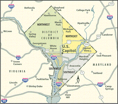
There are no counties in the District of Columbia, only WARDS, for municipal purposes, including local elections and city planning. The District of Columbia is divided into eight wards. Each ward is represented by it's own city council member. These divisions are named by number, 1 - 8.
The ward boundaries, which are based on population, were last set by lawmakers in 2012, following the 2010 U.S. Census, and are subject to change, based on the results of the 2020 U.S. Census.
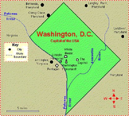
The areas that are now Arlington County and Alexandria, Virginia were part of the District of Columbia until 1846.
Ward 1 consists of the Columbia Heights area, and includes these neighborhoods: Adams Morgan, Columbia Heights, Kalorama Triangle, LeDroit Park, Mount Pleasant, Park View, Pleasant Plains, Shaw, and the U Street NW corridor.
Ward 2 consists of the Pennsylvania Ave NW & 15th St NW area and includes these neighborhoods: Burleith, Chinatown, Downtown, Dupont Circle, Foggy Bottom, Georgetown, Logan Circle, National Mall, Penn Quarter, Shaw, Kalorama, U Street NW corridor, and West End.
Ward 3 at 3101 Wisconsin Ave NW, consists of the following neighborhoods: American University Park, Cathedral Heights, Chevy Chase, Cleveland Park, Forest Hills, Foxhall Crescent, Foxhall Village, Friendship Heights, Glover Park, Kent, Massachusetts Avenue Heights, McLean Gardens, North Cleveland Park, Observatory Circle, Palisades, Spring Valley, Tenleytown, Wakefield, Wesley Heights, and Woodley Park.
Ward 4 at Georgia Ave. NW and includes the following Neighborhoods: Barnaby Woods, Brightwood, Brightwood Park, Chevy Chase, Colonial Village, Crestwood, Fort Totten, Hawthorne, Lamond-Riggs, Manor Park, Petworth, Queens Chapel, Shepherd Park, 16th Street Heights, and Takoma.
Ward 5 consists of Brookland and includes the following neighborhoods: Arboretum, Bloomingdale, Brentwood, Brookland, Carver-Langston, Eckington, Edgewood, Fort Lincoln, Fort Totten, Gateway, Ivy City, Langdon, Michigan Park, North Michigan Park, Pleasant Hill, Queens Chapel, Stronghold, Trinidad, Truxton Circle, and Woodridge.
Ward 6 at 225 7th St SE, consists of the following neighborhoods: Barney Circle, Capitol Hill, Capitol Riverfront, Hill East, H Street NE corridor, Kingman Park, L’Enfant Plaza, Mount Vernon Triangle, Navy Yard, Near Northeast, NoMa, Shaw, and Southwest Waterfront.
Ward 7 at 4500 Benning Rd NE, consists of the following neighborhoods: Benning Heights, Benning Ridge, Benning, Burrville, Capitol View, Civic Betterment, Deanwood, Dupont Park, Eastland Gardens, Fairfax Village, Fairlawn, Fort Davis Park, Good Hope, Greenway, Hillcrest, Kenilworth, Kingman Park, Lincoln Heights, Marshall Heights, Mayfair, Naylor Gardens, Northeast Boundary, Penn Branch, Randle Highlands, River Terrace, Skyland, and Twining.
Ward 8 consists of Congress Heights, consists of the following neighborhoods: Anacostia, Barry Farm, Bellevue, Buena Vista, Congress Heights, Douglass, Fairlawn, Garfield Heights, Joint Base Anacostia-Bolling, Shipley Terrace, Skyland, Washington Highlands, and Woodland.
|

 GenealogyForum.com District of Columbia File Library
 Let me know what you think about this site, E-mail GoldenGateServices@aol.com.